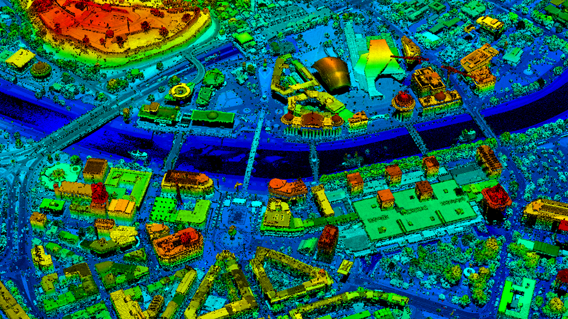
New digital elevation models in North Macedonia
By using airborne LiDAR scanning from an airplane, this project focuses on establishing a highly accurate digital elevation models for the territory of North Macedonia ready for distribution to the end user through the LiDAR portal.
Project facts
-
Project period: June 2018 - December 2022
-
Total area scanned in the first campaign: ca. 11 800 km2
-
Ca. 13 900 km2 - scanning in progress
-
LiDAR scanning with a point density of 2 p/m2 and 5 p/m2
-
Classified point cloud, DTM and DSM can be purchased via AREC Geo portal (freely available for partners).
LiDAR (Light Detection And Ranging) surveying provides high accuracy Digital Elevation Model (DEM) data, which allows capture of the bare earth structure that satellites cannot see, as well as ground cover in enough detail to allow vegetation categorization and change monitoring.
The high resolution and positional accuracy of LiDAR means it can be used to capture and measure above-ground features over large areas including power lines, building outlines and towers.
Big impact
The data created will be particularly useful and very valuable for flood risk mitigation, flood monitoring and for actions during flood situations in flood exposed areas, but also for reducing costs of infrastructure projects, enhancing environmental protection and monitoring and spatial planning.
– Lidar project is one of the projects that will have maybe biggest impact on the North Macedonian geospatial community and society nowadays, Sasho Dimeski, project manager at Agency for Real Estate Cadastre (AREC) said.
– Through this project for the first time Lidar technology is used in North Macedonia for acquiring highest quality geospatial data essential in different areas of the society.

Sharing data
One of the objectives of the project was to develop a new technical solution for distribution of electronic terrain data.
LiDAR portal was established in order to provide public access to LiDAR data and derived products to all interested users. Data from the LiDAR scanning has also been shared with the United Nations Development Programme's country office, as part of their strategic plan for implementation of the sustainable development goals through the ongoing project "Improving Resilience to Floods in the Polog Region”.
Without sufficient, reliable, up-to-date high-resolution digital maps achieving these goals is not possible. Thus, it is natural to share responsibilities and strengthen joint efforts to fight the threat of climate change.
Lidar project is one of the projects that will have maybe biggest impact on the North Macedonian geospatial community and society nowadays.
Sasho Dimeski, project manager at AREC
Capacity building
As a part of every developing project, the Norwegian Mapping Authority promotes sharing experiences and transfer knowledge to our project partners. In this project, we have successfully enhanced capacity at AREC for maintaining and distributing digital terrain data.

The mail has been sent!