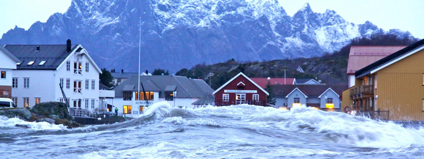
What does storm-surge mean?
A storm-surge occurs when meteorological effects cause an extreme rise in water levels. Especially wind and changes in air pressure affect the water level.
Changes in air pressure and wind can significantly change the water level. This is what happens when a storm-surge occurs: Low air pressure leads to high water levels. As a general rule, if the air pressure drops by one hectopascal (hPa) or one millibar (mb), the water level rises by one centimetre. A powerful low pressure system of 960 hPa will cause the water to rise approximately 50 centimetres.
Wind impact
Wind also plays a crucial role in how high the water level is. The wind can push water towards the shore, creating an excess of water concentrated along the coast. When it comes to the Norwegian coast, this is mostly wind from the south and west.
Strong winds in the North Sea can also create long waves that travel along the coast, causing water levels to rise dramatically even though the wind is calm locally.
Storm-surges and high tides
Extremely high water levels occur when a storm-surge coincides with so-called high astronomical tides. Tidal differences vary in a lunar cycle, and we experience the largest differences one to two days after the new and full moons in western and northern Norway. These are called spring tides.
In Southern Norway and the Oslo fjord, the spring tides occur two to three days before the new and full moons.
Major devastation after a storm-surge
The Bay of Bengal is an area in the world that is often affected by storm-surges. Low-lying areas with high population density are most susceptible to damage during storm-surges, and there are many places around the world where storm-surges have resulted in disasters in which many lives have been lost.
In 1970, a tidal wave killed hundreds of thousands of people in Bangladesh.
In 1900, at least 8000 people were killed when Galveston in Texas was hit by a storm-surge that occurred after a hurricane had passed through. In 2008, Hurricane Ike caused major devastation in the same area, with a storm-surge of 5 to 6 meters in height. The storm-surge that occurred after Hurricane Katrina in 2005 is considered one of the worst in the United States, with water levels of 7 to 9 meters above normal tides.
One of the largest storm-surge disasters in Europe occurred in the North Sea in 1953. 50 dikes burst in the Netherlands and 1800 people lost their lives. The other side of the English Channel was also affected. 307 people lost their lives in the UK.
Storm-surges have also caused major flooding along the Norwegian coast. One example is Storm Berit that occurred in 2011, which set new records for the highest observed water level for most of the water level meters in Northern Norway.
Municipal planning advice
The Norwegian Directorate for Civil Protection (DSB) has published a guide called ‘Integrating Sea Level Rise and Storm Surges in Local Planning’. This provides advice on how municipalities and others can obtain an overview of the dangers, risks and vulnerabilities in relation to sea level rise, storm-surges and wave impact.
More frequent and higher storm-surges in the future
Projections of sea level changes along the Norwegian coast to year 2100 is calculated in a report from 2015. The report was commissioned by the Norwegian Environment Agency and compiled by the Norwegian Mapping Authority and the Bjerknes Centre. It describes how the sea will rise along the Norwegian coast during this century, and how it will affect water levels during a storm-surge.
Se havnivå i kart Visualize Sea Level
See consequences of sea level changes in an interactive map. The web tool visualize present-day storm surge levels and future sea level rise:
Se havnivå Water Level and Tides
Se havnivå provides information about water level, tides, vertical datums, land uplift and future sea level projections for the Norwegian coast:


The mail has been sent!